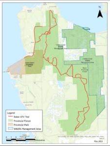
Digital download trails for various ATV Clubs region are made available in several digital GPS formats and detailed .JPG and/or .PDF maps are also provided to download and print if you wish.
NOTE: Designated ATV trails are signed and managed while non-designated trails also shown in the data files are other forest trails that may or may not be passable due to overgrowth, dead fallen trees and wet areas. These additional trails are shown only for purposes of showing riders what other trails surround the designated trails and provide for added navigational assistance when leaving the designated trails. It is up to the rider to exercise due diligence on any and all trails due to potential changing conditions and the fact that they are off road trails, the terrain and conditions can be quite varied. ATV riders are reminded that they ride these trails at their own risk and judgement.
Polaris Ride Command:
In addition to making all our trails data available for download to install into your own GPS unit or to print maps, we have also formed a Partnership with Polaris company and our ATV trails are now available for use through their free mobile Ride Command application available from your device app store for both Android and Apple devices and also Microsoft computers. Now even without a GPS unit, you can turn on your phone and follow all the trails while navigating with live tracking and also record your rides and make new waypoints. Learn all about it through this Polaris Ride Command link.
Download our digital Designated Trails: KML | GPX
To download other trail files click on this link to our Data Warehouse.

